Soham South Ward

Polling Station - Soham South LG3

Location

Soham - Walter Gidney Pavilion (LG3)
Fountain Lane Soham
CB7 5PL Ely
GB

Ward: 

  • Soham South Ward

Electoral Area Code: 

60

Streets: 

Adelaide Close, Brewhouse Lane, Brook Dam Lane, Cedar Court, Church Hall Close, Churchgate Street, Clay Street, College Road, Cross Green, Dobede Way, East Fen Common, East Fen Drove, Eastern Avenue, Ennion Close, Fountain Lane, Frederick Talbot Close, Gardeners Lane (1-25 odds), High Street, Hodson Close, Kents Lane, Lines Close, Lode Close, Maple Close, Market Street, Mill Corner, Mynott Mews, Paddock Street, Pratt Street (evens 2-22), Red Lion Square, Regent Place, St Andrews Park, Staploe Mews, Station Road (odds 1-63), White Hart Lane.


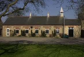
Polling Station - Soham South LG2

Location

Soham - The Coach House
The Red Lion, 17 High Street
CB7 5HA Soham
GB

Ward: 

  • Soham South Ward

Electoral Area Code: 

44

Streets: 

Angle Common, Archers Close, Brook Street, Butts Close, Celandine View, Centre Road, College Close, Cornmills Road, Dace Drive, Emerald Way, Fordham Road, Frank Bridges Close, Gidney Lane, Glenare Court, Greenhills, Hardfields Court, Hawker Drive, Kings Parade, Lark Hall Road, Meadow Close, Meadowhawk, Military Road, Mill Drove, Millcroft, Mistral Close, Morello Chase, Orchard Row, Pennywort, Perch Chase, Red House Gardens, Regal Lane, Sand Street, Skimmer Chase, Staples Lane, Sunburst Green, Symphony Court, Tanners Lane, The Butts, The Causeway, The Crescent, The Oaks, Valerian Gardens, Windmill Close.

Polling Station - Wicken LJ1

Location

Wicken - The Mission Hall
High Street, Wicken, Ely, Cambs
CB7 5XW
GB

Ward: 

  • Soham South Ward

Electoral Area Code: 

47

Streets: 

Back Lane, Barrow Meadow, Butts Lane, Chapel Lane, Church Road, Cross Green, Drury Lane, Hawes Lane, High Street, Lode Lane, Lower Road, North Street, Old School Lane, Padney Road, Pond Green, Redit Lane, Stretham Road, Swallow Tail Close, The Crescent, Upware. 

Subscribe to RSS - Soham South Ward